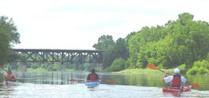
Grand River Kayak’s territory covers the length of the Grand River as it flows through Haldimand County, from Caledonia (launch # 25) in the north, to Lake Erie (launch # 32). We have YEARS of experience paddling this stretch of the Grand River. We are here to assist, whether you need a shuttle for your own kayak, canoe or SUP, or need a rental, or a guided trip. Your safety, and enjoyment of the Grand River, are our primary concerns.
Courtesy of the Grand River Conservation Authority.
This is a list of major access and pull-out points on the Grand. In addition, many bridge crossings on the Grand have road allowances on either side, which permit public access to the river.
Please respect private property while accessing the river. Be careful on steep or slippery banks. River conditions vary and may change, sometimes suddenly. Man-made obstacles, obstructions, alterations, or new construction on or near the river may also change or affect river conditions.
Remember that SAFETY is a personal responsibility.
More information on these access points is available in the book Paddling the Grand River which includes map locations for each one.
1) Belwood Village
Follow Wellington County Road 26 to Wellington County Road 19 in Belwood. Turn west on County Road 19 and access the lake from a Conservation Authority property downstream of the bridge on the right-hand bank (entry fee).
2) Belwood Lake Conservation Area
You can enter through the main gate of the Belwood Lake Conservation Area (entry fee), just off the Fergus-Orangeville Road (Wellington County Rd. 18). Access to the reservoir is upstream of the Shand Dam. You can also access the river from below the dam, off the park service road leading to the swimming area.
3) Elora Gorge Conservation Area (camping)
You enter the Elora Gorge Conservation Area from Wellington County Road 21 and access the river from the low-level bridge at the downstream end of the park (entry and camping fee).
4) Downstream of Inverhaugh at Wilson’s Flats
You can enter and pull out at Pilkington Eighth Line Rd. EW, approximately 2 kilometres downriver of Inverhaugh off Wellington Country Road 21. If you are canoeing or kayaking, this is the first bridge downstream of the Elora Gorge Conservation Area. Stick to the main channel.
5) West Montrose
Immediately downstream of the covered bridge on the left bank, off Rivers Edge Drive. Nearby Letson Park provides parking (day use only).
6) Winterbourne
Turn west off Regional Road 23, onto Woolwich Township Road 48 (Peel St.) near the Winterbourne Christian School. You can access the river from the left bank on the downstream side of the old iron bridge.
7) Conestogo Village
Below the junction of the Conestogo River and the Grand River at a low bank area on the left off Waterloo Regional Road 17. This is about 1.0 kilometre west of the junction with Regional Road 23. The access point is directly under the hydro tower corridor over the river, on the left bank 0.8 kilometre downstream of the bridge over the Grand in Conestogo.
8) Waterloo – Kaufman’s Flats
The entrance to the Flats is east off University Avenue East, just north of Lexington Road in Waterloo. It is about 200 metres down the hill from University Avenue East. Park beside the river at the Claude Dubrick Trailway – Walter Bean Trail parking lot.
9) Kitchener – Bridgeport
Turn in to the first parking lot entrance to the Joe Thompson Sportsfield at the east end (left bank) of the Bridge St. bridge across the Grand in Kitchener (Bridgeport). Walk up the ramp at the west end of the lot onto the flood protection dike. Walk a few metres upstream on the dike and take the left fork down to the river, and put in to the river at the footing of the bridge.
10) Kitchener – Bingemans (camping)
Bingemans is on the eastern edge of Kitchener at 425 Bingemans Centre Drive, just off Victoria Street (Hwy. 7). River access is on the right bank behind the Embassy Room building. Pull out from the river 30 minutes downstream of the Bridgeport bridge on the right bank immediately downriver of the trailers along the river (camping fee and no launch fee). If you see the Victoria St. (Hwy. 7) bridge, you have paddled too far.
11) Kitchener – Stanley Park
The entrance to the parking lot is on Shirley Drive, just north of Highway 7/Victoria Street, on the right bank, immediately before Highway 7 crosses the Grand River in Breslau. It is necessary to portage around two small ponds to reach the river.
12) Kitchener – Freeport
Schneider Park is on the west side of King St. E. across from Freeport Hospital downstream of the old Hwy. 8 or King St. E. bow string bridge.
13) Cambridge (Blair) – Moyer’s Blair Landing
Off Fountain Street just downstream of Highway 401 at Moyer’s Blair Landing. The landing is 200 metres downstream of the Fountain St. bridge on the left side.
14) Cambridge (Galt) – Riverbluffs Park
From George Sreet on the right bank approximately 100 metres upstream of the railway bridge, there is a boat ramp at the Cambridge Rowing Club / Ancient Mariners Canoe Club landing for easy pull-out to end a canoe or kayak trip. If your trip extends beyond Cambridge, you must portage across Park Hill Road and put in downstream of the Parkhill Dam. Trips beginning in Cambridge should not start here, but rather at the GTO/Rail-Trail access.
15) Cambridge (Galt) – Cambridge to Paris Rail-Trail
Many canoeists and kayakers use the access downstream of the Petro Canada gas station on the left or east bank off Highway 24 (Water St.) north of Myers Road at the south end of Cambridge. This is also the northern trail head of the Cambridge to Paris Rail-Trail.
16) Glen Morris – Eric Thomlinson Access Ramp
There is a Rail-Trail parking lot at the end of Forbes Street, two blocks south of the Glen View General Store. Access is gained by crossing the Rail-Trail and taking the new path to the river. For pull-out at this location, after paddling under the Glen Morris bridge, take the right channel past the island and immediately cut across the river to the left bank. The left channel has been impassable at times in the past.
17) Paris – Penman’s Dam
Pull out immediately underneath the railway bridge on the east or left bank, but be careful climbing the steep stairs up to Willow Street. Immediately downstream is a dangerous low head dam and cement walls. Access is regained by means of the canoe ramp extending down the dike below the dam on the left side of the river. Stay clear of the “boil” or dangerous undertow below the dam.
18) Paris – Bean Park
For trips starting in Paris, there is more parking and less crowding if you launch at Bean Park, located on the right bank off Race Street in the area of town downstream of the Dundas St. high-level bridge.
19) Brantford – Brant Conservation Area (camping)
Brant Conservation Area is on Jennings Road off Highway 53 on the west side of Brantford. It is the first overnight stop on trips starting from Cambridge. Pull out on the right side above the Wilkes Dam and contact the Area Superintendent for a camping site (entry and camping fee). For trips starting here, there is a new launching area built in 2003 within the park that will eliminate portaging Wilkes Dam.
20) Brantford – Ballantyne Drive
Turn right just after the intersection of Ballantyne Drive and Spalding Drive to the flats along the river. To pull out here, look for a clearing on the right bank and a gravel parking area and road leading up to Ballantyne Drive.
21) Brantford – Gilkison’s Flats
On the west or right bank off Gilkison Street, downstream of the BSAR bridge.
22) Brantford – Cockshutt Bridge
Off Cockshutt Road (Erie Ave.) downstream of the Cockshutt bridge, on the left or north bank of the river.
23) Ohsweken – Chiefswood Tent and Trailer Park (camping)
Between Onondaga and Middleport, turn from Highway 54 onto Chiefswood Road toward Ohsweken. Access to the river is on the left or east bank on the upstream side of the bridge, or downstream at Chiefswood Tent and Trailer Park (admission fee).
24) North of Caledonia – Harrison’s Landing or LaFortune Park
On the left or east bank, just off Highway 54, approximately 2 kilometres downstream of Big Creek. (Launching and/or parking fees may apply and parking is day use only.)
25) Caledonia – Kinsmen Park
Pull out on the left bank above the low head dam or weir, immediately upstream of the railway bridge. From Highway 54 re-enter just below the dam at Kinsmen Park. Stay clear of the “boil” or dangerous undertow below the dam.
26) York – York Park in the village of York
Off Highway 54, just downstream of the York bridge on the left or east bank. The channel running through the park is of historical interest. At one time the channel led to a lift lock, and a dam of the Grand River Navigation Company was situated where the present bridge crossing now stands. Store nearby.
27) Cayuga – Bob Baigent Park
Gain access in Cayuga downstream of the Hwy. 3 bridge on the east or left bank, at the Bob Baigent Memorial Park public boat ramp off Ouse Street. “Ouse” was an early English name for the Grand River. Stores nearby.
28) Dunnville – Byng Island Conservation Area (camping)
Look for the campground on the right side of the river across from Dunnville. Take the first of three channels into the Conservation Area (admission and camping fee, no launch fee). There is a low head dam or weir on each of these channels. To continue downriver from the park, follow the main channel of Sulphur Creek in the Conservation Area back to the Grand to avoid the Dunnville Dam. For road access to Byng, take Rainham Road in Dunnville to Haldimand County Road 20.
29) Dunnville – Wingfield Park
There is a boat launch at Wingfield Park on Main Street, upriver of the Dunnville Dam on the left (town side) of the river.
30) Dunnville – Grand Island Bar-B-Q
The Grand Island Bar-B-Q and boat launch is on the south side of Dover Road at the west end of the bridge across the Grand. *NOTE – THIS LAUNCH IS NOW CLOSED TO THE PUBLIC
31) Dunnville – Dunnville Boat Club
The Dunnville Boat Club and boat launch is on Hydro Street, on the left side of the river immediately downstream of the Dunnville Dam (launch fee).
32) Port Maitland at Lake Erie
At the end of your trip, there is an easy pull-out, on the right bank off The Esplanade Road, at the boat ramp just before the concrete break walls, where the Grand River enters Lake Erie. You can also paddle around the light station and put ashore to the west of the light station.